
- Tag = Kent Maps
-
 A MAP OF THE LOWY OF TUNBRIDGE.
Published: Canterbury, 1782. First folio edition. A very detailed map from Hasted's "History And Topograpical Survey Of Kent", showing the area from Tonbridge to Tunbridge Wells. Page size: 53.2 x 40.2 cms. Good margins. Uncoloured, as issued. Although some fold-marks are evident, these maps are usually preferred to those from the second edition as, not only are they the first printings, but they have fewer crease-marks. Some off-setting to top third of map; small tear to top left edge of map, ending approximately 5mm away from margin; else a very good copy.
More details Price: £125.00 -
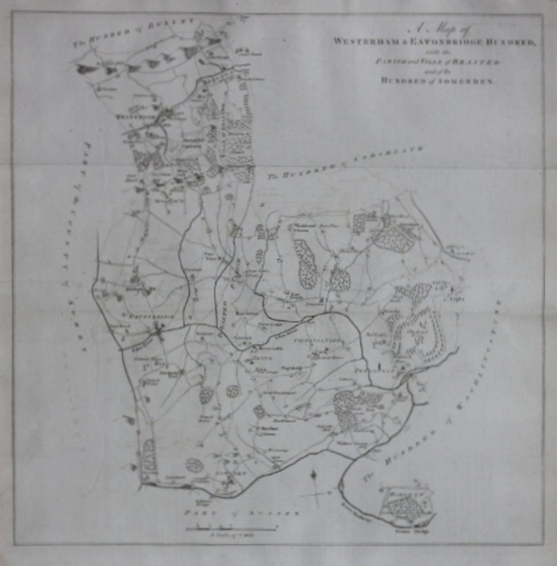
 A MAP OF WESTERHAM & EATONBRDIGE HUNDRED, with the Parish and Ville of Brasted: and of the Hundred of Somerden.
Published: Canterbury, 1778. First folio edition. A very detailed map from Hasted's "History And Topograpical Survey Of Kent", showing the area of Westerham and Eatonbridge to Penshurst and Cowden. Page size: 44.4 x 40.3 cms. Good margins. Uncoloured, as issued. Although some fold-marks are evident, these maps are usually preferred to those from the second edition as, not only are they the first printings, but they have fewer crease-marks. Some off-setting; else a very good copy.
More details Price: £120.00 -
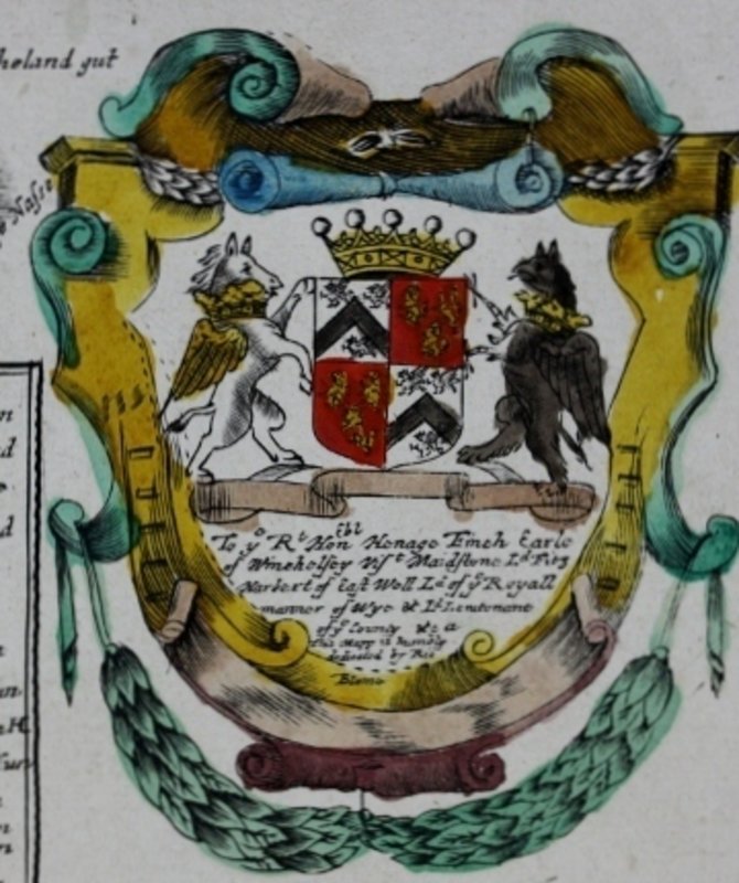
 A MAPP OF KENT With its Lathes and Hundreds.
1673. By Ric: Blome. A coloured copy from Britannia; Or, A Geographical Description of the Kingdoms… 1673. Image size: 32.5 x 26.5 cm's. A very good, clean copy; matted.
More details Price: £275.00 -
![CANTIUM VERNACULE KENT. by [JANSSONIUS, J.].](https://images.vialibri.net/production/21/9019---200.JPG?v=1530264318) CANTIUM VERNACULE KENT.
CANTIUM VERNACULE KENT.
No date [Circa 1646]. Engraved sheet, hand-coloured as issued. The map is landscape: 38.1 x 50.2 cms. Vertical crease mark; else a very good example with excellent colouring.
More details Price: £495.00


![CANTIUM VERNACULE KENT. by [JANSSONIUS, J.].](https://images.vialibri.net/production/21/9019---800.JPG?v=1530264318)