- Tag = Maps
-
 Ordnance Survey Map THE MIDDLE THAMES (from Wallingford to Kew Bridge).
1928. Scale 1 inch to 1 mile. Price 4/- net. Printed on waterproof washable paper. Folding map, circa 1928. Original pictorial covers. Covers rubbed with some light silverfish damage; else a very copy, clean copy.
More details Price: £18.00 -
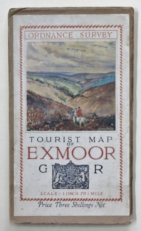
 Ordnance Survey TOURIST MAP OF EXMOOR.
1930. G. R. Scale:- 1 inch to 1 mile. Prince three shillings. Folding, linen-backed, map, circa 1930, folding into card covers with pictorial pastedown on upper cover. Covers a little worn at edges; else a very good copy.
More details Price: £20.00 -
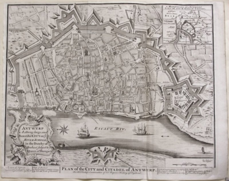
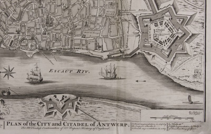
 PLAN OF THE CITY AND CITADEL OF ANTWERP. For Mr. Tindal's Continuation of Mr. Rapin's History of England.
I. Basire Sculpt, No date (circa 1751). Engraved map, uncoloured as issued. Sheet size: 412 x 512 mm (161/4 x 201/4). Small hole to the text border with slight loss of one letters; else a fine impression with original binding folds.
More details Price: £50.00 -
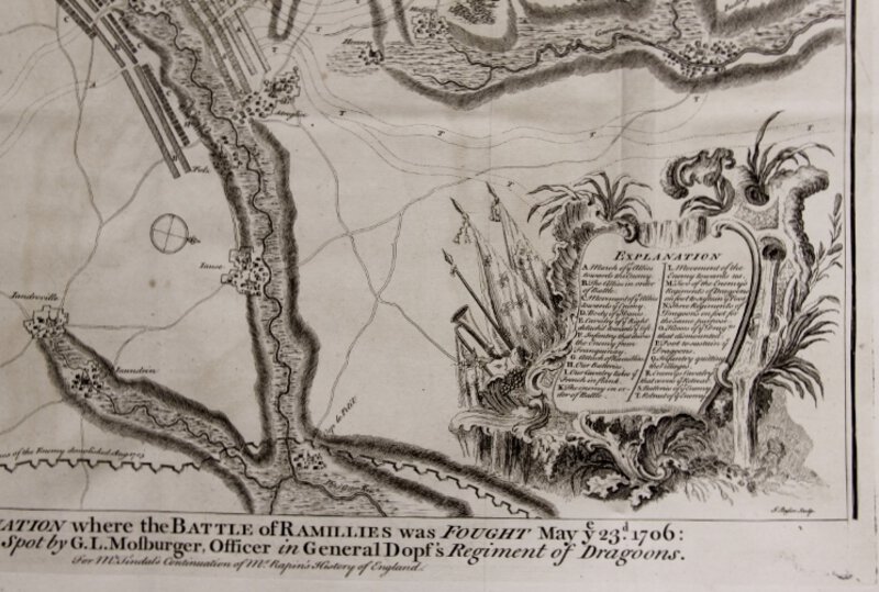
 Plan of the Situation where the Battle of Ramillies was fought May ye 23rd 1706: Designed upon the Spot by G.L. Mosburger, Officer in Geneal Dopf's Regiment of Dragoons. For Mr Tindal's Continuation of Mr Rapin's History of England.
More details Price: £40.00
Plan of the Situation where the Battle of Ramillies was fought May ye 23rd 1706: Designed upon the Spot by G.L. Mosburger, Officer in Geneal Dopf's Regiment of Dragoons. For Mr Tindal's Continuation of Mr Rapin's History of England.
More details Price: £40.00 -
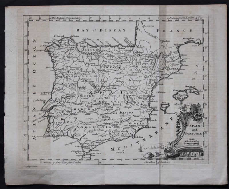
 SPAIN and PORTUGAL.
No date. [Circa 1761]. An engraved map, uncoloured as issued, circa 1761. 21 x 26 cm. Two vertical crease-lines where once folded into a book; else near fine.
More details Price: £75.00 -
 THE CITY OF NAMUR WITH THE CASTLE AND OTHER FORTIFICATIONS. For Mr. Tindal's Continuation of Mr. Rapin's History of England.
Cartographer. Paul Rapin de Thoyras, Date: circa 1751. Engraved map, uncoloured as issued. Sheet size: 413 x 530 mm (161/4" x 21"). Very fine impression with original binding folds.
More details Price: £75.00 -
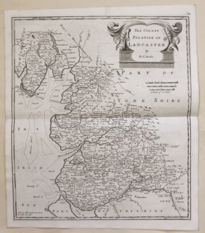
 THE COUNTY PALATINE OF LANCASTER.
Copperplate engraving sold by Abel Swale Awnsham & Jon Churchill. No date [circa 1722]. Sheet size: 44.5 x 39. Printed: 41x 36 cm. Uncoloured as issued. Folded at centre as presented in William Camden's Britannia. A fine copy with good margins.
More details Price: £110.00 -
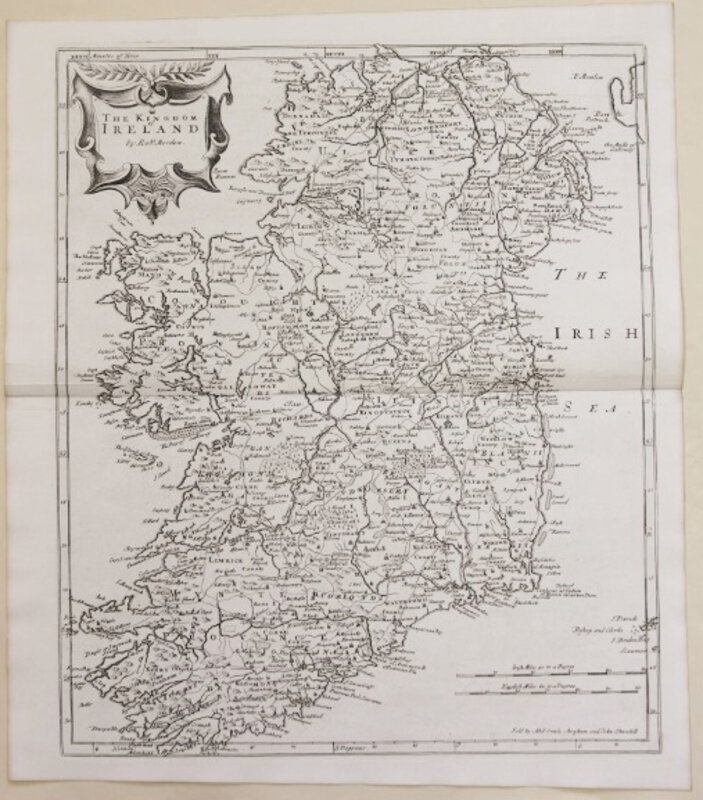
 THE KINGDOM OF IRELAND.
Copperplate engraving sold by Abel Swale Awnsham & Jon Churchill. No date [circa 1722]. Sheet size: 44.2 x 39 cm. Printed image: 40.7 x 34.2 cm. Uncoloured as issued. Folded at centre as presented in William Camden's Britannia. A fine copy with good margins.
More details Price: £185.00 -
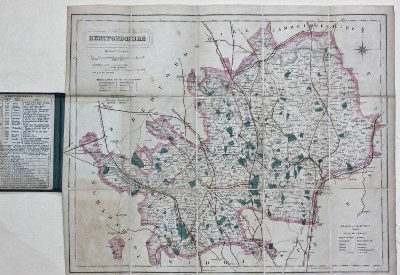
 WALKER'S HERTFORDSHIRE.
London: By J. & C. Walker, No date [circa 1870]. Hand-coloured engraved map divided into 15 sections and mounted on linen, 34.5 x 42 cm, folding into green cloth covers with mounted paper label; printed sheet of statistics relating to the County to front endpaper. Covers: 12.5 x 9 cm. Some light browning; else very good.
More details Price: £50.00 -
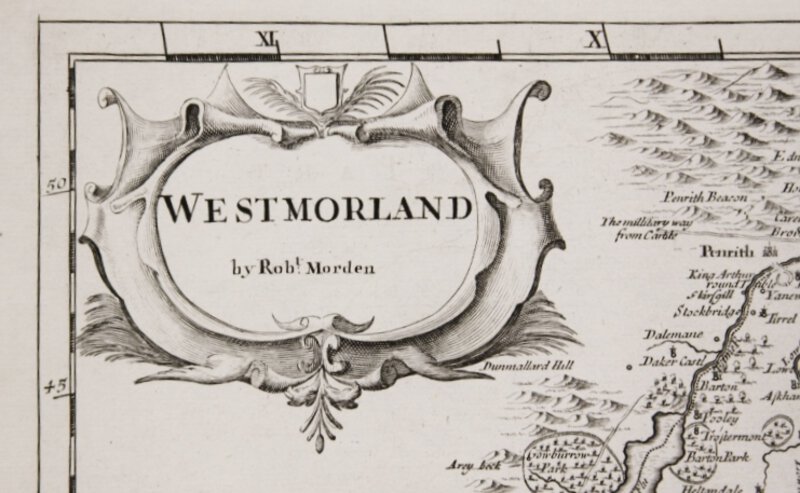
 WESTMORLAND.
Copperplate engraving sold by Abel Swale Awnsham & Jon Churchill. No date [circa 1722]. Sheet size: 39 x 44.3 cm. Printed image: 35.7 x 41.3.cm. Uncoloured as issued. Folded at centre as presented in William Camden's Britannia. A fine copy with good margins.
More details Price: £75.00