Criteria:
- Tag = Atlas
Page:1Modify search
-
 ATLAS MINIMUS, or a New Set of Pocket Maps. Of the several Empires, Kingdoms and States of the known World, with Historical Extracts relative to each. Drawn and engraved by J, Gibson from the Best Authorities. Revis’d, Corrected, and Improved, by E. Bowen, Geographer to His Majesty.
More details Price: £14,500.00
ATLAS MINIMUS, or a New Set of Pocket Maps. Of the several Empires, Kingdoms and States of the known World, with Historical Extracts relative to each. Drawn and engraved by J, Gibson from the Best Authorities. Revis’d, Corrected, and Improved, by E. Bowen, Geographer to His Majesty.
More details Price: £14,500.00 -
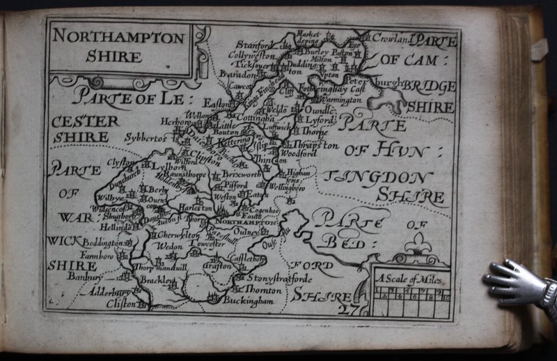
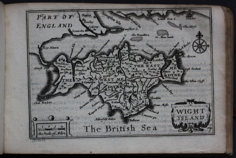
 England Wales Scotland and Ireland Described and Abridged with ye Historic Relation of things worthy memory from a farr Larger Voloume Done by John Speed.
More details Price: £5,950.00
England Wales Scotland and Ireland Described and Abridged with ye Historic Relation of things worthy memory from a farr Larger Voloume Done by John Speed.
More details Price: £5,950.00