
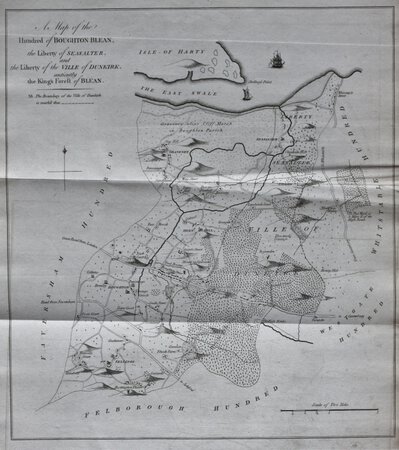


A MAP OF THE HUNDRED OF BOUGHTON BLEAN, the Liberty of Seasalter, the Liberty of the Ville of Dunkirk, antiently the King's Foreft of Blean.
Published: Canterbury, 1790. First folio edition. A very detailed map from Hasted's "History And Topograpical Survey Of Kent", showing the area from the East Swale to Dunkirk and Boughton. Page size: 51.3 x 40.1 cms. Good margins. Uncoloured, as issued. Although some fold-marks are evident, these maps are usually preferred to those from the second edition as, not only are they the first printings, but they have fewer crease-marks. Some light off-setting; else a very good copy.
Book ID: 9307
Print this page
Price:
£120.00