


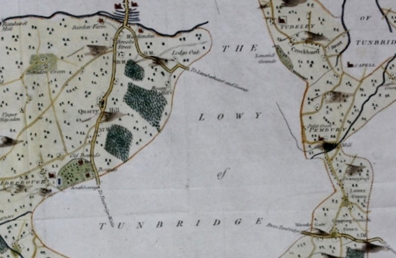
A MAP OF THE HUNDRED OF WATCHLINGSTONE.
Published: Canterbury, circa 1801. Second edition. A very detailed map from Hasted's "History And Topographical Survey Of Kent", showing the area of the Lowy of Tunbridge. Image size: 37.5 x 48.7 cms. Fold-marks evident as usual. Later hand-colouring. Mounted. Some light dust-soiling.
Book ID: 9137
Print this page
Price:
£100.00