

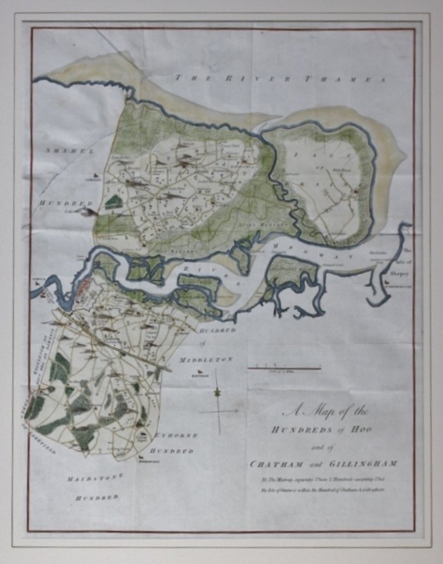


A MAP OF THE HUNDREDS OF HOO and of Chatham and Gillingham.
Published: Canterbury, circa 1801. Second edition. A very detailed map from Hasted's "History And Topographical Survey Of Kent", showing the area of the Isle of Graine through to the Medway Towns. Image size: 46.6 x 35.7 cms. Fold-marks evident as usual. Later hand-colouring. Mounted. One large closed tear, approximately 18 cms long, running from left edge to coloured area in top half of map.
Book ID: 9136
Print this page
Price:
£80.00